The Ultimate Compass: Mastering the Art of Travel Directions in the Modern Age
In an era where GPS navigation has become second nature, understanding travel directions remains essential for both seasoned travelers and first-time explorers alike. Whether you’re navigating through bustling city streets or charting a course across remote landscapes, mastering the nuances of direction can transform your journey from stressful to seamless.
This guide delves deep into the world of travel directions, offering practical advice that transcends basic map reading skills. We’ll explore everything from traditional methods to cutting-edge digital tools, ensuring you have the knowledge to navigate confidently anywhere in the world.
Decoding the Language of Direction
At its core, travel direction is about interpreting spatial relationships between locations. This involves understanding cardinal points—north, south, east, and west—as well as relative terms like left, right, forward, and backward.
Professionals often use azimuths, which measure angles clockwise from north, providing precise directional measurements crucial for surveying and military operations. For everyday travelers, however, simpler orientation techniques suffice.
- Cardinal Points: North, South, East, West form the foundation of any directional system
- Relative Terms: Left/right/forward/backward are context-dependent but universally understood
- Azimuth Measurement: Used by professionals for exact angular positioning (measured in degrees)
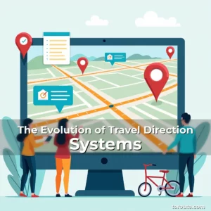
The Evolution of Navigation Tools
From ancient mariners using stars for guidance to modern hikers relying on smartphone apps, navigation technology has evolved dramatically over centuries. These advancements have made once-challenging journeys accessible to everyone.
Toroute members will find particular value in learning how these historical methods inform contemporary practices. Understanding the limitations of past systems helps appreciate today’s sophisticated solutions better.
Historical Milestones in Navigation
The invention of the magnetic compass around 1180 AD revolutionized land navigation. Before that, sailors relied heavily on celestial bodies for orientation at sea.
During World War II, advances in radio navigation technologies allowed pilots to fly accurately even when visibility was poor. This laid the groundwork for future GPS developments.
Digital Mapping and Its Impact
Google Maps and similar platforms have fundamentally changed how we perceive distance and route options. Their real-time data capabilities provide dynamic information that static maps cannot match.
For those exploring unfamiliar territories, features like street view and traffic updates make virtual reconnaissance possible before setting foot outside their homes.
Reading Road Signs and Wayfinding Symbols
Efficient travel requires deciphering visual cues along the way. Standardized road signs vary by country but follow common conventions that most drivers recognize internationally.
Paying attention to color coding and iconography can prevent costly detours. Yellow signs typically indicate caution while green signals safe passage ahead.
- Color Coding: Green = go, yellow = caution, red = stop
- Iconography: Universal symbols help overcome language barriers effectively
- Text Hierarchy: Important information appears prominently above secondary details
Choosing the Right Route: Factors That Matter
Selecting an optimal path depends on several variables including time constraints, vehicle type, weather conditions, and personal preferences. Balancing efficiency against comfort becomes critical during long trips.
Rural roads might offer scenic views but could lack emergency services compared to urban highways. Considering these trade-offs ensures safer and more enjoyable travels.
- Time Constraints: Rush hour congestion affects travel duration significantly
- Vehicular Requirements: Large vehicles need wider lanes and lower clearance limits
- Weather Conditions: Rain/snow impact traction levels and visibility
Navigating Without Technology
While smartphones are invaluable, knowing alternative methods proves vital in areas with limited connectivity. Traditional skills like landmark recognition remain surprisingly effective under certain circumstances.
Celestial navigation using constellations provides reliable bearings when electronic devices fail unexpectedly. Learning key star patterns enhances survival chances during outdoor excursions.
- Landmark Recognition: Identifying distinctive structures aids orientation without tech
- Sun Positioning: Tracking sunlight movement indicates approximate cardinal directions
- Constellation Knowledge: Specific star formations reveal true north in clear skies
Interpreting Public Transportation Routes
Urban mobility relies heavily on understanding transit networks. Subway maps use simplified layouts that emphasize connections rather than geographic accuracy.
Finding transfers between different lines usually follows logical patterns based on station proximity and service frequency. Planning ahead minimizes waiting times substantially.
- Transfer Logic: Stations serving multiple lines facilitate smooth transitions
- Service Frequency: High-frequency routes reduce overall commuting durations
- Peak Hours: Crowded periods require extra planning for efficient travel
Special Considerations for Different Travel Modes
Bicyclists face distinct challenges requiring specialized routing considerations. Bike paths differ greatly from pedestrian walkways, necessitating careful selection of appropriate trails.
Skiers must account for elevation changes and snow conditions affecting trail accessibility. Real-time avalanche alerts become crucial components of winter sports planning.
- Bicycle Infrastructure: Dedicated bike lanes ensure safer riding experiences
- Ski Trail Accessibility: Snow depth and temperature influence terrain usability
- Weather Monitoring: Regular updates prevent unexpected disruptions due to natural elements
Etiquette and Safety While Following Directions
Maintaining situational awareness prevents dangerous encounters with other road users. Observing speed limits and yielding properly fosters harmonious coexistence among travelers.
When unsure about a turn, signaling intentions clearly reduces collision risks. Using hazard lights appropriately communicates potential delays or obstacles ahead.
- Speed Limit Compliance: Adheres to local regulations enhancing safety margins
- Proper Signaling: Turns indicated early enough gives others sufficient reaction time
- Hazard Lights Usage: Alerts following vehicles about temporary stopping situations
Future Trends in Navigation Technology
Emerging innovations promise to redefine how we interact with our environments. Augmented reality overlays may soon project navigational instructions directly onto physical surroundings.
Artificial intelligence integration enables predictive routing based on user behavior analysis. These smart systems learn from past choices to optimize future journeys automatically.
- Augmented Reality: Superimposes digital guidance onto real-world visuals
- AI Predictions: Analyzes patterns to suggest personalized route alternatives
- Autonomous Vehicles: Self-driving cars represent next-generation transport solutions
Conclusion
Mastering travel directions equips individuals with indispensable life skills applicable beyond simple commutes. From leisurely vacations to professional assignments abroad, good navigation abilities enhance every aspect of global exploration.
By combining traditional wisdom with modern technological advantages, travelers gain unparalleled flexibility in choosing their preferred modes of transportation worldwide. Embrace these principles wholeheartedly to unlock new horizons wherever your adventures take you next.
“`html
“`